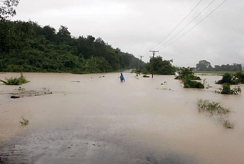
Rain-triggered floods have displaced people from low-lying areas in Ngaputaw, Myaungmya, Belin, Myawady and Hpa-An Townships, according to sources.
The water level of Belin River in Mon State reached 1,029 cm, exceeding its danger mark of 1,022 cm.
San Naing, chair of Belin Township Social Organization said: “According to the measurement at 5.30 pm, the river water level exceeded its danger mark. we have to open more relief camps. We are helping flood victims relocate to the relief camps, in cooperation with the army, police, auxiliary fire brigade and social organizations.”
Mon State MP Dr. Khin Naing Oo from Belin Township Constituency-1 said: “We provided 10 village-tracts on the upstream of Belin River with rice, edible oil , salt, bottled water, fish cans and dry noodle packets, three week ago. We are monitoring the situation as the water level continues to rise.”
A total of 15 schools are temporarily closed due to the floods. Currently, a total of 5,356 people from 1222 households are taking shelter at 28 flood relief camps in Belin Township.
In addition, the authorities have opened three relief camps in Myaungmya Township in Ayeyawady Region since 6 August due to the heavy downpours. About 187 people from 43 households are taking shelter at three relief camps opened at the monasteries.
The water level in Myaungmya Township exceeded its danger mark. The flooding is expected to hit the township for the next three days due to incessant rains.
Tinchaung village-tract administrator Kyaw Myint Tun said: “Due to high tide and heavy downpours on August 5, floods affected 165 houses six villages in Tinchaung village-tract in Ngaputaw Township in Ayeyawady Region. A total of 119 households were relocated to the temporary relief camps. We also moved animals to a safer place. The floods damaged 217 baskets of paddy in Wetkaw village.”
Likewise, the water level of Thanlwin River in Hpa-An Township in Kayin State, reached 850 cm, exceeding its danger mark of 750 cm.
Currently, flood victims from wards-1,2 and 5 are evacuated to four relief camps. The authorities are compiling the list of households and population. Plan is underway to open more relief camps if necessary.
A local from Hpa-An said: “Last year, the region experienced the worst flooding within 53 years. The water level reached a record high of 938 cm. The region faced the flood disaster for nearly two months. In the past, the region faced flooding every three years. Beyond 2015, the flooding hits the region every year. I think it is a warning bell for us to be cautious about Thanlwin River.”
Due to rain-triggered floods and the rising water level of Thaungyin River, more than 1,500 people from low-lying wards are taking shelter at four relief camps in Myawady district in Kayin State.