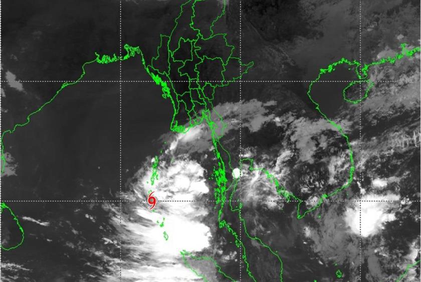
A well-marked low pressure area over South Andaman Sea and adjoining Southeast Bay of Bengal has intensified into a depression, which is heading towards Myanmar, according to the Department of Meteorology and Hydrology (DMH).
It is centered at about 260 nautical miles South-Southwest of Coco Island, about 390 nautical miles South-Southwest of Hainggyikyun, about 420 nautical miles Southwest of Dawei, about 360 uautical miles West of Kawthaung (Myanmar), about 40 nautical miles North-Northwest of Nicobar Islands and about 110 nautical miles South-Southwest of Port Blair (India).
It will move towards Myanmar coasts, the present stage of the depression is coded orange stage. Depression is located at Latitude 9.8 degree North and Longitude 92.5 degree East, center pressure of depression is 1004 hPa and maximum wind speed near the center is 35-40 miles per hour at (09:30) hrs MST today.
The depression is likely to move Northwards and forecast to intensify into a deep depression during next 24 hrs and into a cyclonic storm during next 48 hrs. It may lead to near Coco Island in the evening of 21.3.2022, near Hainggyikyun, Ayeyawady Region in the morning of 22.3.2022 and near Rakhine coast in the evening of 22.3.2022, Myanmar.
Due to the depression, rain or thundershowers will be fairly widespread to widespread in Nay Pyi Taw, Lower Sagaing, Mandalay, Magway, Bago, Yangon, Ayeyarwady and Taninthayi Regions and Shan, Chin, Rakhine, Kayah, Kayin, Mon States with regionally and isolated heavy falls in some Regions and States during this morning to 22.3.2022, the DMH reported.