The depression that is developing in the Bay of Bengal will not enter Myanmar, but due to the intensity of the storm, it will rain across the country and some areas will experience heavy rain, announced the Department of Meteorology and Hydrology (DMH).
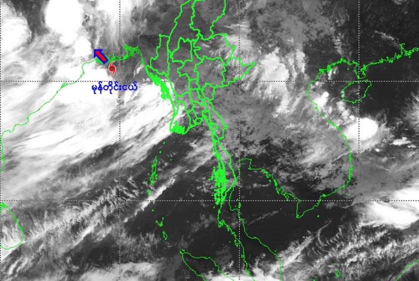
According to the measurements on the morning of July 25, the low pressure area in the northern Bay of Bengal has slowly moved west-northwestwards and has reached the north-western Bay of Bengal and the coasts of West Bengal, India and Bangladesh.
The depression is centered about 205 nautical miles west-northwest of Sittway, about 70 nautical miles south of Mongla, Bangladesh, about 80 nautical miles southeast of Sagar Island, India and about 95 nautical miles southeast of Kolkata, the DMH has announced.
The depression is currently in a yellow condition and is not expected to move towards Myanmar. The cyclone is likely to move west-northwestwards and cross the coast of West Bengal and adjoining Bangladesh in the next 6 hours. It is expected to cross the coast of West Bengal and adjoining Odisha and Jharkhand in the next 24 hours.
Due to the strength of the depression and the strong monsoon winds in the Andaman Sea and Bay of Bengal, rain and thundershowers will be fairly widespread to widespread in Nay Pyi Taw, Yangon, Mandalay, Bago, Magway, Sagaing, Ayeyawady, Tanintharyi regions, and Kachin, Kayah, Kayin, Chin, Mon, Rakhine and Shan states, with regionally heavy falls in some areas.
The heavy rain is accompanied by strong winds, thunderstorms, lightning, hail, flash floods and landslides. Residents living near highlands in these areas are advised to be aware of the risk of landslides, and those living near small rivers and streams are advised to take precautions to avoid flooding and to take necessary precautions for inland waterways, aviation and dams, announced the DMH.