The depression will become a cyclonic storm on May 26 and may cross Bangladesh and isolated heavy falls along with strong winds may occur in all regions and states, announced the Department of Meteorology and Hydrology (DMH) on May 25.
According to the announcement, the depression in the East-central Bay of Bengal has moved north-northeast and has become a deep depression and is centered at about 305 nautical miles northwest of Coco Island, about 285 nautical miles west-northwest of Hainggyigyun, about 270 nautical miles west-southwest of Thandwe, about 230 nautical miles southwest of Sittway, about 250 nautical miles south of Khepupara, Bangladesh, about 250 nautical miles south-southeast of Sagar Island and 275 nautical miles south-southeast of Canning, West Bengal, India.
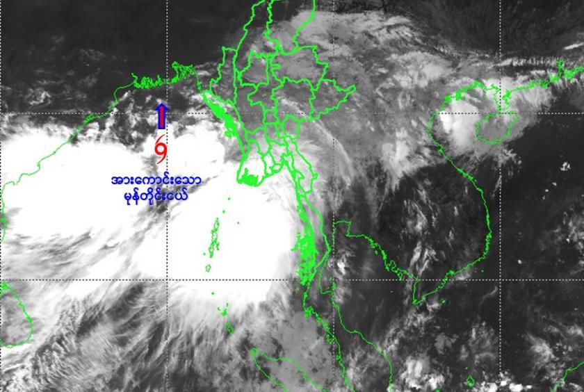
The current condition of the deep depression is not likely to move towards Myanmar, so the present stage of the deep depression is coded yellow stage. According to the forecast at 9:30 am, the deep depression is located at 17.8 degrees north latitude and 89.7 degrees east longitude, with a central pressure of 993 hPa and a maximum wind speed of 35 miles per hour.
The deep depression may move to the north, and in the next 12 hours, it will further intensify in the central-eastern Bay of Bengal and the adjoining northern Bay of Bengal, and may become a cyclonic storm. After that, it may continue to move northward and strengthen into a severe cyclonic storm in the northwestern Bay of Bengal and adjoining northeastern Bay of Bengal on the morning of May 26. On the night of May 26, it may cross Khepupara, Bangladesh and adjoining West Bengal coasts near Sagar Island, India.
Under the influence of deep depression, rain or thundershowers will be fairly widespread to widespread in Nay Pyi Taw, Sagaing, Mandalay, Magway, Bago, Yangon, Ayeyawady, Taninthayi regions and Kachin, Chin, Rakhine, Kayin, Mon states with likelihood of regionally and isolated heavy falls in some regions and states along with strong winds from the morning of May 25 to 27.
Occasional squalls with rough seas will be experienced in Gulf of Martaban, off and along Mon-Taninthayi Coasts. Surface wind speed in squall may reach 40-45 mph and wave height will be about 9-12 feet on May 25. Frequent squalls with rough to very rough seas will be experienced in Deltaic, off and along Rakhine Coasts. Surface wind speed in squall may reach 50-60 mph and wave height will be about 13-18 feet from May 25 to 26.
Under the influence of deep depression, people should be aware of heavy rain with strong wind, flash flood and landslide in the hilly areas and near small rivers and also domestic flight, trawlers, vessels and ships off and along Myanmar Coasts, warned the DMH.