The depression moving at a speed of up to 40 miles per hour is likely to intensify into a cyclonic storm during next 24 hours and lead to near Coco Island noon today, the Department of Meteorology and Hydrology (DMH) announced at 7am today.
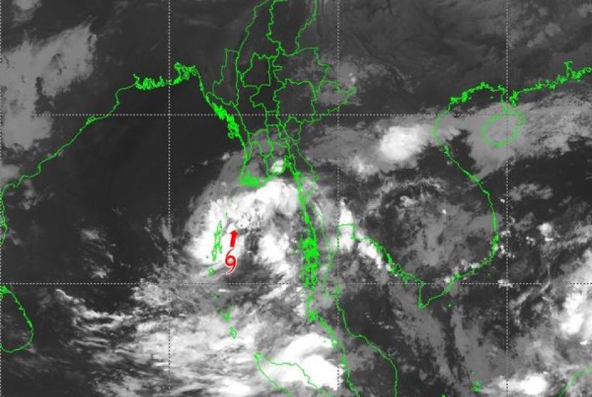
According to the observations at 05:30 hrs M.S.T today, the depression over North Andaman Sea and adjoining Southeast Bay of Bengal has moved North-Northeastwards and it is centered at about 150 nautical miles South-Southeast of Coco Island, about 270 nautical miles South-Southwest of Hainggyikyun, about 310 nautical miles Southwest of Dawei, about 305 nautical miles West-Southwest of Myeik, about 375 nautical miles Southwest of Mawlamyine, about 350 nautical miles South-Southwest of Yangon (Myanmar),about 150 nautical miles North-Northeast of Nicobar Islands and about 45 nautical miles East of Port Blair (India).
The present stage of the depression is coded orange stage, and it will move towards Myanmar coasts. Depression is located at Latitude 11.6 degree North and Longitude 93.5 degree East, center pressure of depression is 1002 hPa and maximum wind speed near the center is 35-40 miles per hour at 05:30 hrs MST today.
The depression is likely to move Northwards along and off Andaman and Nicobar Islands and forecast to intensify into a deep depression during next 12 hrs and into a cyclonic storm during next 24 hrs. It may lead to near Coco Island noon today, near Hainggyikyun, Ayeyawady Region in the morning at 22.3.2022 and near Rakhine coast in the morning at 23.3.2022, Myanmar, the DMH reported.