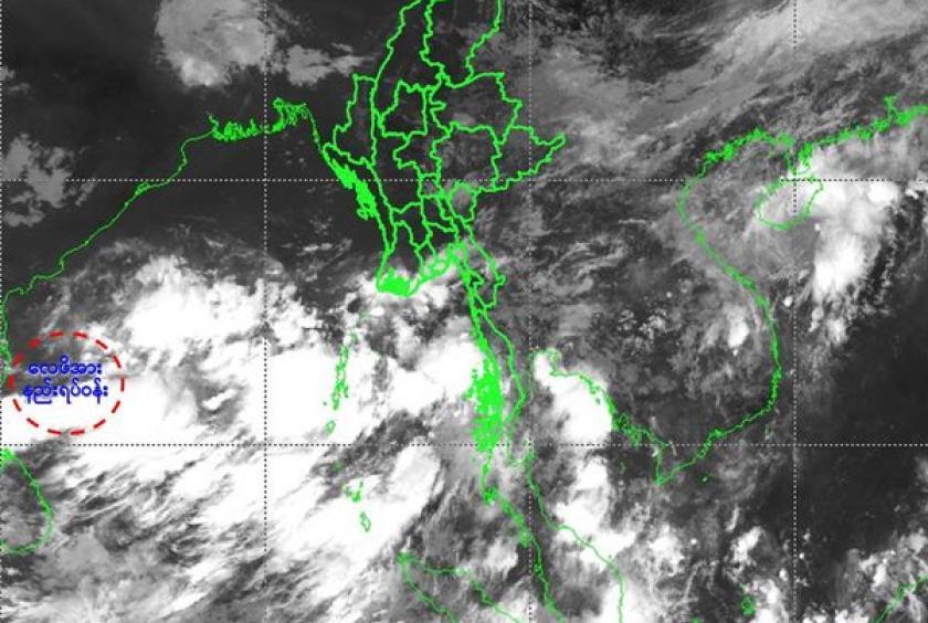
A low-pressure area has formed in the Bay of Bengal and may develop into a depression or cyclonic storm, according to the Department of Meteorology and Hydrology (DMH).
As of 9:30 AM on May 22, Myanmar Standard Time, the low-pressure system was located in the southwestern and west-central Bay of Bengal, impacting the northern Tamil Nadu and southern Andhra Pradesh coasts of India. This system is projected to move northeastward, potentially intensifying into a depression in the central Bay of Bengal by May 24 and possibly developing into a cyclonic storm.
The DMH forecasts heavy rain and strong winds in Nay Pyi Taw, Sagaing Region, Mandalay Region, Magway Region, Bago Region, Yangon Region, Ayeyawady Region, Taninthayi Region, Chin State, Rakhine State, Kayin State, and Mon State from May 23 to 27. Isolated heavy rainfall and strong winds are expected in some areas.
Occasional squalls with heavy rainfall and large waves are also anticipated along the Mottama Gulf, Mon-Taninthayi coastal areas, and offshore waters. During these squalls, wind speeds could reach up to 40 miles per hour, with wave heights between 9 and 12 feet. In the delta areas, Rakhine coastal areas, and offshore waters, frequent squalls with winds reaching 45 to 55 miles per hour and wave heights between 13 and 16 feet are expected.
Residents in hilly areas and near small rivers and streams are advised to take precautions due to the potential for heavy rain, strong winds, sudden flooding, and landslides. The DMH also advises inland air travel and coastal and offshore fishing boats and vessels to take preventive measures. Warnings have been issued to ensure preparedness.