Myanmar is expected to have more rain due to rainclouds in Gulf of Martaban and whirlwind from Gulf of Thailand although low pressure area is weakened, said Dr Kyaw Moe Oo, Director General of Department of Meteorology and Hydrology (DMH).
“The low pressure area is weakened but circulations are still present. The wind speed has only about 15 or 20 mph. More rain will be expected. Bago, Yangon and Ayeyawady regions will have more rain due to rainclouds in Gulf of Martaban,” said Dr Kyaw Moe Oo.
A whirlwind from Gulf of Thailand will cross Myanmar on October 25 and it will make more rain in Myanmar, said the director general.
“If whirlwind from east arrives in Myanmar, it may make a low pressure area. We have to monitor it. Most of the Weather Research and Forecasting models (WRF) said a whirlwind will be heading to Myanmar. One or two WRFs forecasted it is likely to become a low pressure area. We forecasted rain will be continued to fall a whole month,” he said.
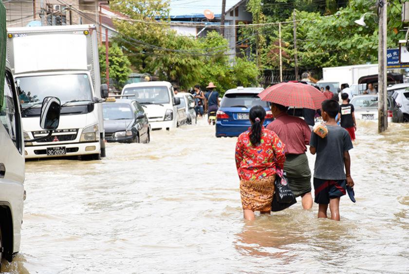
According to observations made by the DMH on October 23, weather was partly cloudy in Sagaing and Taninthayi regions and Kachin and Chin states and rain or thundershowers will be isolated in Magway Region and Rakhine State, fairly widespread in Mandalay Region and Mon State, scattered in Ayeyawady Region and Shan (north) and Kayin State, widespread in the remaining regions and states with isolated heavy falls in Ayeyawady Region. Recorded rainfalls are 5 inches in Hintada, 2.91 inches in Bago, 2.32 inches in Kayan, 2.01 inches in Gyobingauk, 1.97 inches in Zalun, 1.73 inches in Monghsat, 1.49 inches in Loikaw, 1.46 inches in Toungup, 1.38 inches each in Zaungtu and Nyaunglaybin respectively.
The low pressure area over deltaic area and adjoining east central Bay of Bengal has become unimportant. Weather is a few clouds over the north Bay and west central Bay and partly cloudy to cloudy over the Andaman Sea and elsewhere in the Bay of Bengal.
According to observations made by the DMH on October 24, rain or thundershowers will be isolated in Sagaing Region, Kachin and Chin states, scattered in Magway and Taninthayi regions and Rakhine State, fairly widespread in Mandalay Region, Kayin and Mon states and widespread in the remaining regions and states with isolated heavy falls in Bago, Yangon and Ayeyarwady regions and Mon State.
Squalls with moderate to rough seas are likely at time off and along Myanmar coasts. Surface wind speed in squalls may reach 35 mph. Wave height will be about 7-10 feet off and along Myanmar coasts.
The DMH forecasted the likelihood of scattered to fairly widespread rain or thundershowers in Bago, Yangon, Ayeyawady and Taninthayi regions, Shan, Kayah, Kayin and Mon states in next two days time.