A low pressure area may occur over Bay of Bengal on August 9, according to Department of Meteorology and Hydrology (DMH).
“Some output models showed the sign of low pressure area but it will not be long. Some showed it will enter into India. Monsoon wind will be strong around August 9 and 10 and in Rakhine on August 11 and 12,” said Dr Kyaw Moe Oo, Director General of DMH.
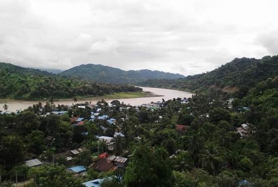
According to the weather observation for August 7, rain or thundershowers will be isolated in lower Sagaing Region, scattered in Mandalay and Magway regions and Kachin State, fairly widespread in upper Sagaing and Taninthayi regions, Shan (east) and Kayah states and widespread in the remaining regions and states with likelihood of isolated heavy falls in Yangon Region and Rakhine State.
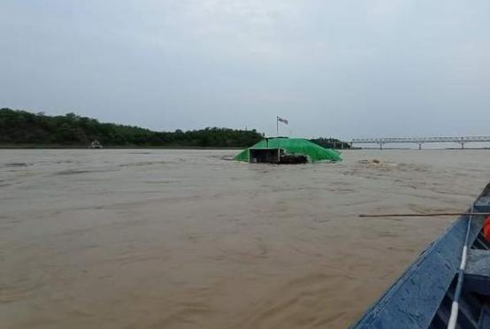
The recorded rainfalls are 4.80 inches in Gwa, 3.90 inches in Kyaukphyu, 3.19 inches in Maungdaw, 3.15 inches in Oakkan, 3.11 inches each in Sittwe and Yangon (downtown), 2.72 inches in Yankalaung, 2.68 inches in Taunggut, 2.64 inches in Arn, 2.44 inches in Hlaingbwe, 2.09 inches in Maubin, 2.05 inches in Kawkareik and 2.01 inches in Banmaw respectively.
Monsoon is moderate over the Andaman Sea and Bay of Bengal, it said.
According to the weather observation for August 8, rain or thundershowers will be isolated in lower Sagaing Region, scattered in Mandalay and Magway regions, fairly widespread in upper Sagaing Region, Kachin and Kayah states and widespread in the remaining regions and states with likelihood of isolated heavy falls in upper Sagaing Region, Kachin, Rakhine, Kayin and Mon states. Degree of certainty is 100%, it said.
Squalls with moderate to rough seas are likely at time off and along Myanmar coasts. Surface wind speed in squalls may reach 30-35 m.p.h. Wave height will be about 7-9 feet off and along Myanmar coasts, it said.