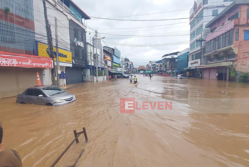
The water level of the Thaungyin River continued to rise due to the continuous rains caused by Cyclone Wipha, and on July 24, the low-lying areas and high-altitude areas including the Bayint Naung Road at the top of the Friendship Bridge, and the intersection of Kyan Khin Road, were flooded.
The heavy rains caused by the storm caused flooding in Myawady and Mae Sot districts, on the Myanmar-Thai border.
The Thaungyin River, which flows from the Walley Creek, Gow Lee Creek, and Mae Kala Creek south of Myawady, has risen above its danger level, and houses in the valley below Kyauk Pya Gate in Ward No. 4, the valley below Thayet Pin Gate in Ward No. 5, the valley below Thae Pon Gate and the valley below Khun Sa Win in Ward No. 2 have been flooded.
"We live in the valley below the Thayet Pin Gate. We came here knowing that we would have to offer alms in the morning. We ran to the evacuation center yesterday when the water entered the lower floor of our house. Now both the lower and upper floor have been submerged. We have put our belongings on the attic. Last year, we lost almost ten million kyats worth of our belongings when the roof submerged. If the roof submerged again, we will lose everything," said a 50-year-old woman who is taking refuge with her family at the religions hall of Dhidhan Aung Pagoda.
The Myawady District Disaster Management Team has opened 11 relief camps in each relevant ward and is working to ensure timely evacuation, food and health care for the flood-affected people.
According to the measurement at 6:30 am on July 24, 2025, the water level of the Thaungyin River exceeded the danger level of 963 centimeters and reached 1,299 centimeters, and the flood level was 336 centimeters above the danger level.