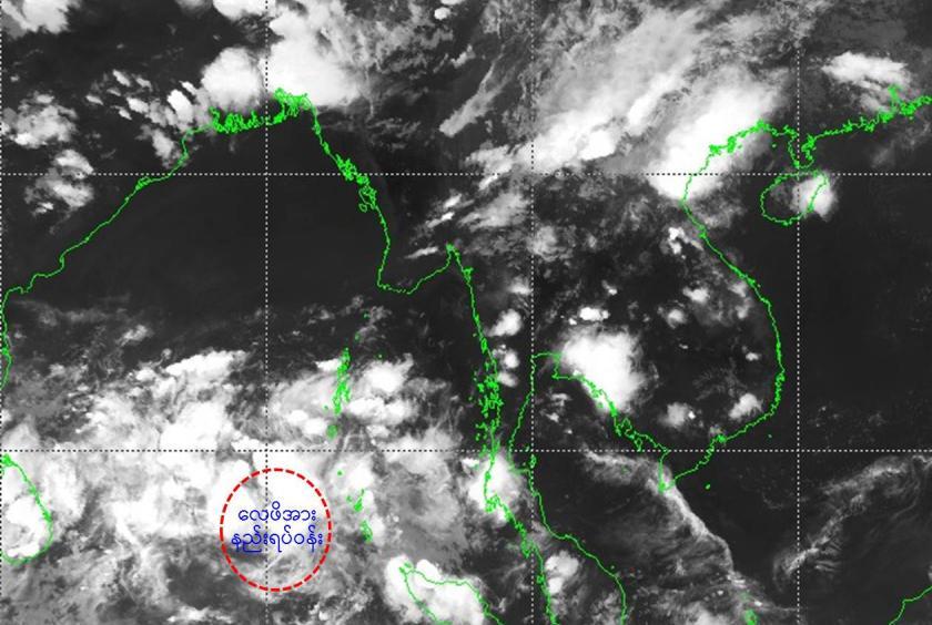
A low pressure area has formed over southeast Bay of Bengal and adjoining the south Andaman Sea and may change into a depression within 48 hours, announced the Department of Meteorology and Hydrology (DMH).
According to the observations made on May 13 by the DMH, a low pressure area has formed over southeast Bay of Bengal and adjoining the south Andaman Sea. It may further intensify into a depression during the next 48 hours and then it is likely to move northwest wards initially.
“It became a low pressure area and it may intensify into a depression within one or two days. It may reach a cyclonic storm in the present conditions around May 17 or 18. It is initially moved to west-northwest wards and can change direction into north-northeast wards after it moved upwards. The air flow is normally moved like that in May,” said Hla Tun, Deputy Director of the DMH.
Moreover it may move upwards after it heads to west-northwest wards and when it reaches beyond latitude 15 degrees, it may change into north-northeast wards, he said.
“If it is moved to west-northwest wards, it may reach into Indian coast as the coast of India is located in mid-west of Bay of Bengal. If it is moved to north-northeast wards, it may head to Bangladesh and Myanmar,” he said.
The forecast to predict the direction of the storm will be precise more after the low pressure area intensifies into a depression, he added.
Among storms that occurred in Bay of Bengal and Andaman Sea between 1897 and 2010, 20 of them entered Myanmar.
The storms occurred in Bay of Bengal in April, May, October and November and depressions usually occur in the monsoon season in the north of Bay of Bengal. Storms occurred in pre and post rainy seasons caused major destructions.
Three destructive powers of the storms are strong wind, heavy rainfall and storm tide. Maximum wind speed may be 120 to 130 mph based on the wind speed and size if a storm crosses Myanmar coast. Wind speed, heavy rain and storm tide will be high if the storm is severe. Rakhine coast and deltaic areas have the impact from the storm and Chin and Shan states and Magway, Mandalay and Sagaing regions will have regionally rainfall, flash floods and strong wind due to the storms.