

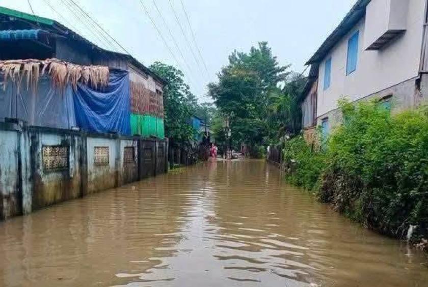
Rising water levels in the Bago River have caused flooding in low-lying areas of Bago Township, according to local residents.
As of 7 am. on July 29, several low-lying areas across Bago Township had been inundated following heavy rainfall, residents said.
A local resident reported that floodwater in low-lying parts of Myothit Ward had reached about four feet deep, while some areas of Kyaukgyi Su Ward were under approximately two feet of water.
Flooding of around two feet was also reported along Mingalar Road. In Kalyarni Ward, low-lying areas including Territory Nos. 4, 6, 16 and 21 were also inundated to a depth of about two feet.
Residents warned that water levels could rise further if heavy rain continues.
Flooding has also been reported on Kwet Thit roads, Nat Sein Pain Road and Padamyar Road. In Myothit Ward, some of the worst-affected areas have been inundated to depths of approximately four feet six inches, according to residents.
The danger level for the Bago River is 880 centimeters. Measurements taken at 12:30 pm. on July 29 showed the river level at 853 centimeters, just 27 centimeters below the danger level.
Meanwhile, the danger level for the Zaungtu River is 900 centimeters. Its water level currently stands at 569 centimeters, which is 331 centimeters below the danger level.
Relevant authorities are closely monitoring river levels and flooding conditions and are continuing to carry out necessary flood prevention, emergency response and rescue operations, according to reports.