

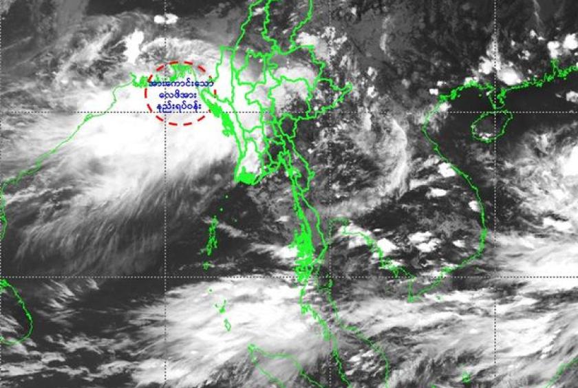
The whirlwind has turned into a low pressure area, and six regions and four states, including Nay Pyi Taw, are expected to experience heavy rain and strong winds, announced the Department of Meteorology and Hydrology (DMH).
According to the forecast made on September 13, the whirlwind developing in the northeast of the Bay of Bengal and the related southeast of Bangladesh has strengthened and intensified into a low pressure area. The low pressure area will slowly move to the west-northwest and become stronger in the next 48 hours. It may reach the coast of West Bengal and northwestern Bay of Bengal as a depression.
Due to the speed of the low pressure area and the continued strength of the monsoon in the Andaman Sea and the Bay of Bengal, rains and thundershowers will be widespread in Chin and Rakhine states with regionally and isolated rainfalls, fairly widespread from widespread in Sagaing, Magway, Bago, Yangon, Ayeyawady, Tanintharyi regions, and Kayin and Mon states, along with heavy rain and strong winds, warned the DMH.
In addition, natural disasters such as strong winds, flash floods and landslides accompanied by heavy rain can occur and those live near the highlands are at risk of landslides and people who live near small rivers and small streams need to be cautious as floods may occur. The DMH has issued a notification in advance and to alert domestic shipping and aviation.
In addition, occasional squalls with rough seas will be experienced in Deltaic, off and along Rakhine Coasts. Surface wind speed in squalls may reach 40-45 mph. Wave height will be about 9-11 feet in Deltaic, off and along Rakhine Coasts, according to the DMH.