

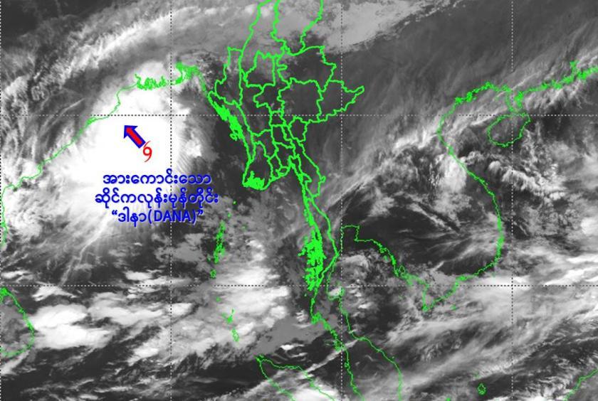
Due to the Cyclonic Storm, rain or thundershowers are likely to be fairly widespread to widespread in Nay Pyi Taw, Sagaing, Mandalay, Magway, Bago, Yangon, Ayeyawady Regions and Kachin, Northern Shan, Chin, Rakhine States with likelihood of regionally and isolated heavyfalls and strong winds within one day according to DMH.
According to the observations at (17:30) hrs MST today, the Cyclonic Storm “Dana” has moved northwest- wards and it is centered at about 365 nautical miles westwards of Gwa(Myanmar), 165 nautical miles south-southeast of Dhamara, Orissa (India).
It does not intend to move towards Myanmar coasts at the present stage and therefore Cyclonic Storm is coded as yellow stage. It is likely to continute to move northwestwards and may further intensify into a Severe Cyclonic Storm over Northwest Bay of Bengal around 24-10-2024 and cross North Odisha and West Bengal Coasts between Puri and Sagar Island close to Dhamara(India) early morning of October 25.
Frequently squalls with rough to very rough seas will be experienced in Deltaic, off and along Rakhine Coasts. Surface wind speed in squalls may reach (50-55) mph and wave height will be about (11-15) feet Deltaic, off and along Rakhine Coasts.
There may be natural disasters such as the heavy rainfall with strong wind, thunder, lightning, hails, flash floods and landslides in the hilly areas and near small rivers and warning has been issued to inland water transport and domestic flights according to Department of Meteorology and Hydrology.