
The Department of Meteorology and Hydrology (DMH) has issued a statement saying that isolated heavy rains and strong winds are likely to occur in some regions and states from November 8 to 10 due to the cloud broken apart from Typhoon “Kalmaegi” forming in the South China Sea.
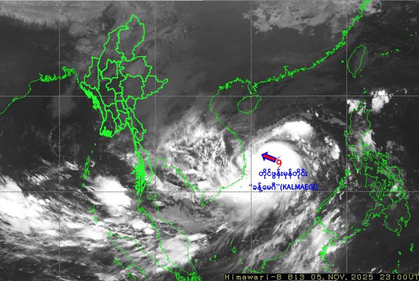
According to the statement, Typhoon “Kalmaegi” forming in the South China Sea is moving west-northwestward and is centered about 330 nautical miles east-southeast of Da Nang, Vietnam.
Typhoon “Kalmaegi” is located at 13.3 degrees north latitude and 113.1 degrees east longitude, with a central pressure of 955 hectopascals and maximum sustained winds of 85 miles per hour.
Typhoon “Kalmaegi” is expected to move westward and cross the Vietnamese coast south of Da Nang on the evening of November 6, then move west-northwestward and continue to cross the border of Vietnam and Laos as a strong tropical cyclone within the next 24 hours.
Due to the cloud broken apart from the Typhoon “Kalmaegi”, rains and thundershowers will be fairly widespread to widespread in Nay Pyi Taw, Yangon, Bago, Ayeyawady and Tanintharyi regions, and Kayah, Kayin, Mon, Rakhine and southern and eastern Shan states from November 8 to 10 with the isolated heavy falls in some areas. There may be occasional heavy rains and moderate to large waves in the delta, Mottama Bay, along the Mon-Taninatharyi coast and offshore. During heavy rains, the sea and land wind may reach at 25 to 30 mph. The wave height may be about seven to nine feet in the delta, Mottama Gulf, along the Mon-Taninatharyi coast and offshore.
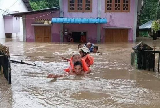
Due to this, natural disasters such as strong winds, thunder, lightning, hail, flash floods and landslides may occur along with heavy rains. Those living near the highlands in these areas are advised to be aware of the risk of landslides, and those living near small rivers and streams are advised to be aware of floods and inundations and to avoid inland waterways, and to make necessary preparations for aviation and irrigation dams, warned the DMH.