

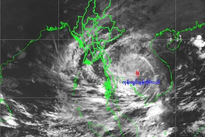
Although typhoon Kalmaegi has weakened into a tropical depression, scattered heavy rainfall is still expected in some parts of Myanmar, according to a weather alert issued by the Department of Meteorology and Hydrology (DMH).
The storm, which had moved across inland areas of Laos, has shifted westward and weakened into a depression along the Laos–Thailand border. The DMH forecasts that within the next 12 hours, it is likely to further weaken into a low-pressure area over eastern Thailand.
Due to the remnant of cloud from Typhoon “KALMAEGI”, rain or thunder showers will be fairly widespread to widespread in Nay Pyi Taw, Yangon, Bago, Ayeyawady and Taninthayi Regions and Kayah, Kayin, Mon, Rakhine and (southern and eastern) Shan States with regionally and isolated heavy falls in some region during 8 to 10 November 2025. Squalls with moderate to rough seas are likely at times in the Deltaic, the Gulf of Mottama, off and along the Mon-Taninthayi Coasts. Surface wind speed in squalls may reach 25-30 miles per hour. Wave height will be about 7-9 feet in the Deltaic, the Gulf of Mottama and Mon-Taninthayi coast.
People should be aware of natural disasters such as the heavy rainfall with strong wind, thunder, lightning strike, lightning, hail, flash floods and landslides in hilly areas and near small rivers and to make necessary preparations for inland water transport, domestic flights and irrigation dams.