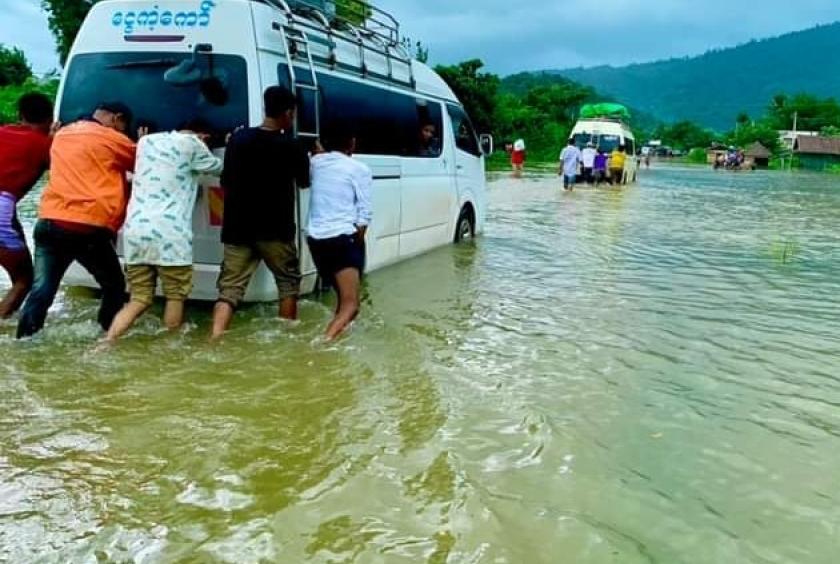
The Taninthayi River has reached a dangerous water level, submerging over 10 villages and parts of the Union Highway.
As of the morning of July 27, the Taninthayi River in Taninthayi Region was only six inches away from the danger level of 24 feet, and by the afternoon, it had reached this critical point. Due to this, over 10 villages, including areas in and around Taninthayi Town, are now experiencing flooding.
Additionally, sections of the Union Highway, including Banlamut Village Road and Letaungya Village Road, are submerged, making them impassable for small vehicles.
"With heavy rainfall in the Dawei area, the creeks and the Taninthayi River have been rising continuously. Within a day, it surpassed the warning level, and the next day it reached the danger level. Large and small creeks in Taninthayi Town, including Monsu Ward, are now submerged. Only the market area and higher ground remain unaffected. More than 10 villages are flooded. We have heard of one casualty. Villagers are relocating to hilltop gardens, monasteries, and relatives' houses on higher ground," said a local resident of Taninthayi Town.
Due to the rising Taninthayi River, over 10 villages in the Pawa, Mawtone, Nyaung Pin Kwin, and Mya Maohn Village Tracts are submerged. The Union Highway in Letaungya Village is also flooded, making it impossible for small vehicles to pass, a traveler reported.
The Taninthayi River's warning level is 17 feet, and the danger level is 24 feet. Currently, it has reached the danger level, and with ongoing rainfall, the river could pose an even greater threat.